
Thurs. Dec 12th The Mayan Ruins & Costa Maya, Mexico
Feast of Virgin of Guadalupe and Deloris and Rudy’s anniversary. Good day to be in Mexico. We had room service coffee and oatmeal and fruit. Later we went out and stood at the rail on Deck 12 and watched the boat dock. First the huge ship did a complete rotation then backed up to the long wooden pier, beside a much smaller Norwegian Cruise ship. On a perpendicular dock was a massive ship, another Royal Caribbean, much larger than the Liberty of the Seas. The water was blue as the sky and crystal clear. We could see the bottom looking straight down over our balcony.
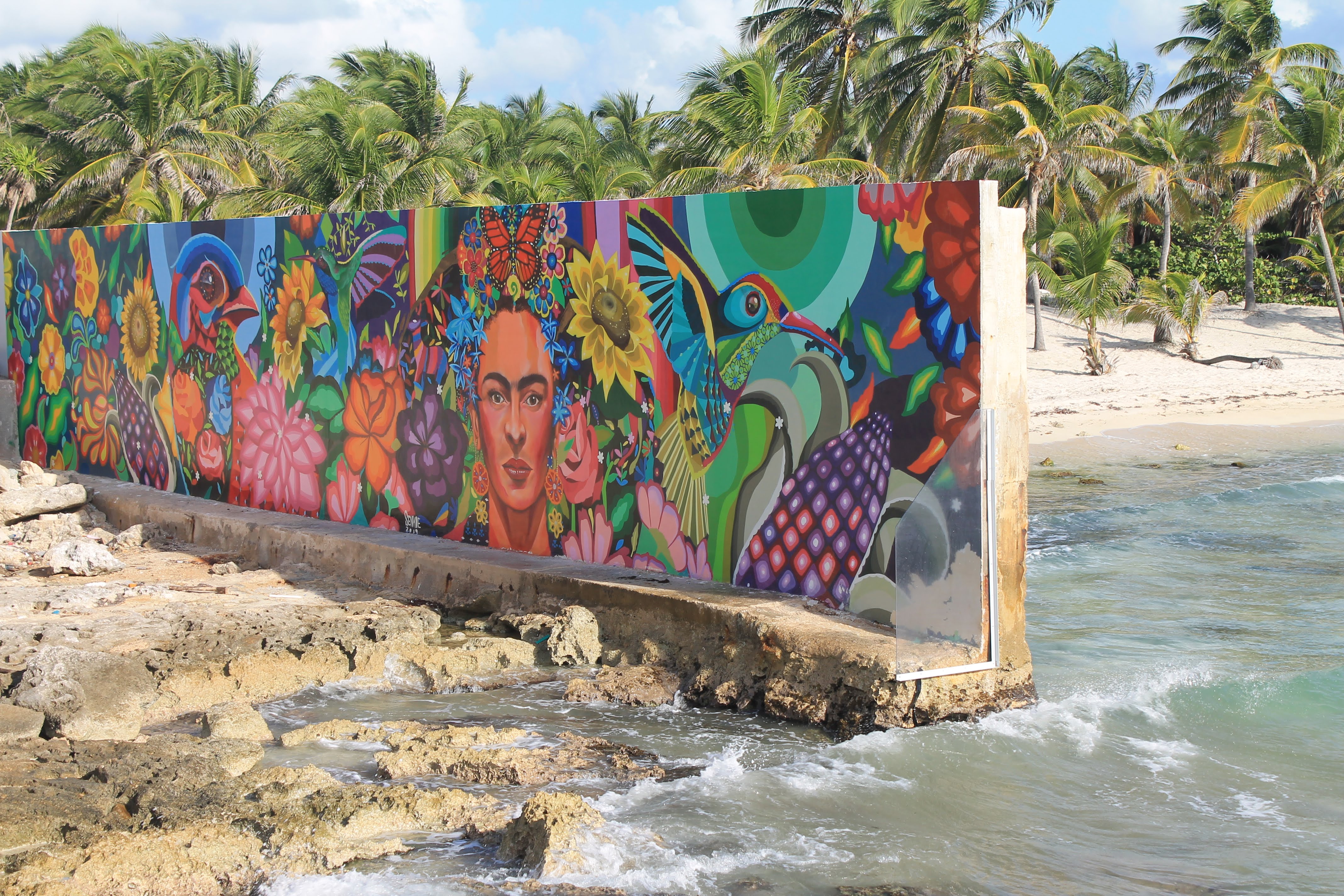
We packed our bag, which was the green shoulder purse I purchased the day before, with the essentials; fresh water, sunscreen, and wallet then headed out to Purerto Costa Maya, a port city on the Yucatan Peninsula. We passed a mural on a wall as we stepped onto the land from the long pier. It was very colorful, depicting a native woman’s face surrounded by many flowers, a bird and rainbow colors.
This is a beautiful city, sitting on this beautiful shore of the Caribbean, surrounded by lush green hills and jungle. Here too, we were met by local musicians. One man we passed on the long dock as we were making our way to shore, wore lose fitting white shirt and trousers and a traditional Mexican hat and was playing a harp. Polar opposite of our musical greeting in Honduras.
We met JR and Jackie once we were outside the boat and we ran into Dee and Rudy as we were heading for our meeting place for our excursion to the Mayan ruins. I had my knee brace on again today, hoping it might help. It took us over two hours on the bus to get to Kohunlich Mayan Ruins. While we drove down the roads, we passed houses that by our standards (as middle class citizens in the US) were hovels, mostly of cinder-block painted in bright colors with tin roofs. We passed many open markets with thatched or tin roofs, selling fresh fruit, honey and other food and miscellaneous items. As we got further out in the country, there was more a mix of nice homes, set back from the road and shacks surrounded by junk. Not much different than rural Kentucky.
Our tour guide introduced himself as Roberto, and our driver as Raphael. Roberto immediately began to narrate our trip with a steady stream of information. I did try to keep up and take notes, so I now know that Mexico is a huge exporter of pineapples. Probably all the pineapples we buy in the US were grown here. Another big crop is sugar cane. We passed miles and miles of sugar cane fields. That is why food processed in Mexico is made with real sugar, not sucrose or corn syrup, like in the US.
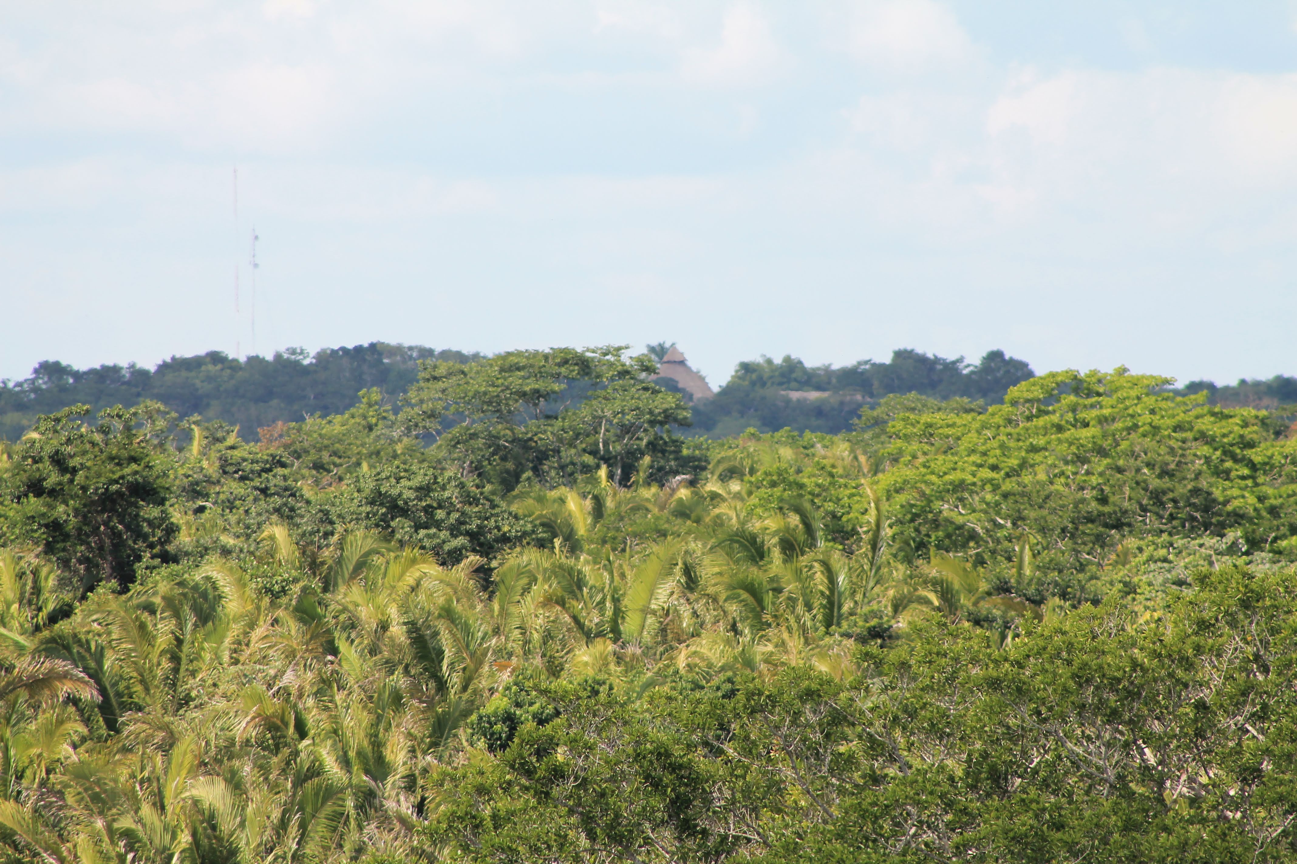
There are over 12,000 caves on the Yucatan Peninsula and these caves hold water, underground lakes and rivers that are the water source for the people and animals that live here. There is only one rainy season, November through May, and all the water runs to the underground waterways, thus the caves are considered sacred by the natives. The jungles we drove through are not like the rain forests of Central America and the Amazon, not jungles at all, but just forests of trees, that are neither very attractive nor overly tall.

Roberto continued with the information dump. He told us Costa Maya was in the very southern part of Mexico, very close to the border of Belize, which is also on the Yucatan Peninsula. He told us that his country has multiple climates and diverse geography. The west is mostly mountains and the north in Chihuahua is desert and mountains, jungles in the southern regions and tropical climates along the coasts. Mexico City, the capital is gigantic with approximately the same population as all of Canada. (I just Googled this stat and it is not true. Canada’s population was 37 million to and Mexico City’s 21.5 million people as of 2019. Up from 8.8 million in 2015.) Mexico City is the site of the great Aztec empire. And 95% population of Mexico have some Aztec or Mayan ancestry.

The scenery we passed was interesting. And I tried to pay attention to what was being said, while we drove down the highway, passing flat scrub land, lots of stubby trees and short palms. We were told that we were driving through the mangroves, a forest of short trees or shrubs that grow in tropical coastal swamps. We passed through many small and medium sized cities; some I read on the many road signs along highways 307 and 186; Pedro Antonio Santos, Bacalar City, and Xul-Ha, Ucum.
Roberto told us there was a shortage of housing during the tourist season, which is September to May, when the weather is more tolerable, not unbearably hot. The rainy season is June through November. It rains every day. He eventually found a good place to live, but it has one drawback. The house is crooked. Apparently it had been tilted on its foundation after a hurricane. He said it was a nice place and quite comfortable but he had to sleep in a hammock to keep from rolling off his bed at night. After the first hour, our guide was getting good and goofy. When talking about the local weather he said a person could say, “Winter is coming, NOT,” unlike Jon Snow of Game of Thrones. I also heard the name “Gandalf”, of Lord of the Rings mentioned, but not sure what that was about. As he continued with his stream of consciousness, he compared the ancient Mayan culture to aliens, as in ET. Again he lost me.
After two hours of this, the bus turned down a country road and we drove for another 10 minutes or so to the park, actually the sign said, Kohunlich Zona Arqueologica, Patrimonio Cultural. In English, Kohunlich Archeological and Cultural Center. First we had to be checked in at the small official looking information building. There were three dogs hanging around outside to greet us. One was laying on a bench, enjoying the belly rubs she was getting from the visitors. Another had what appeared to be an enlarged teat. It was so elongated that it was almost dragging in dusty road. No puppies around. And the third, a rangy yellow dog with patches of missing fur and a set of intact male dog parts, trotted around the parameters of our group. I did see a water bowl near the building, and the dogs did not look like they were starving, but they obviously were not receiving the level of care expected for their cousins in the US.
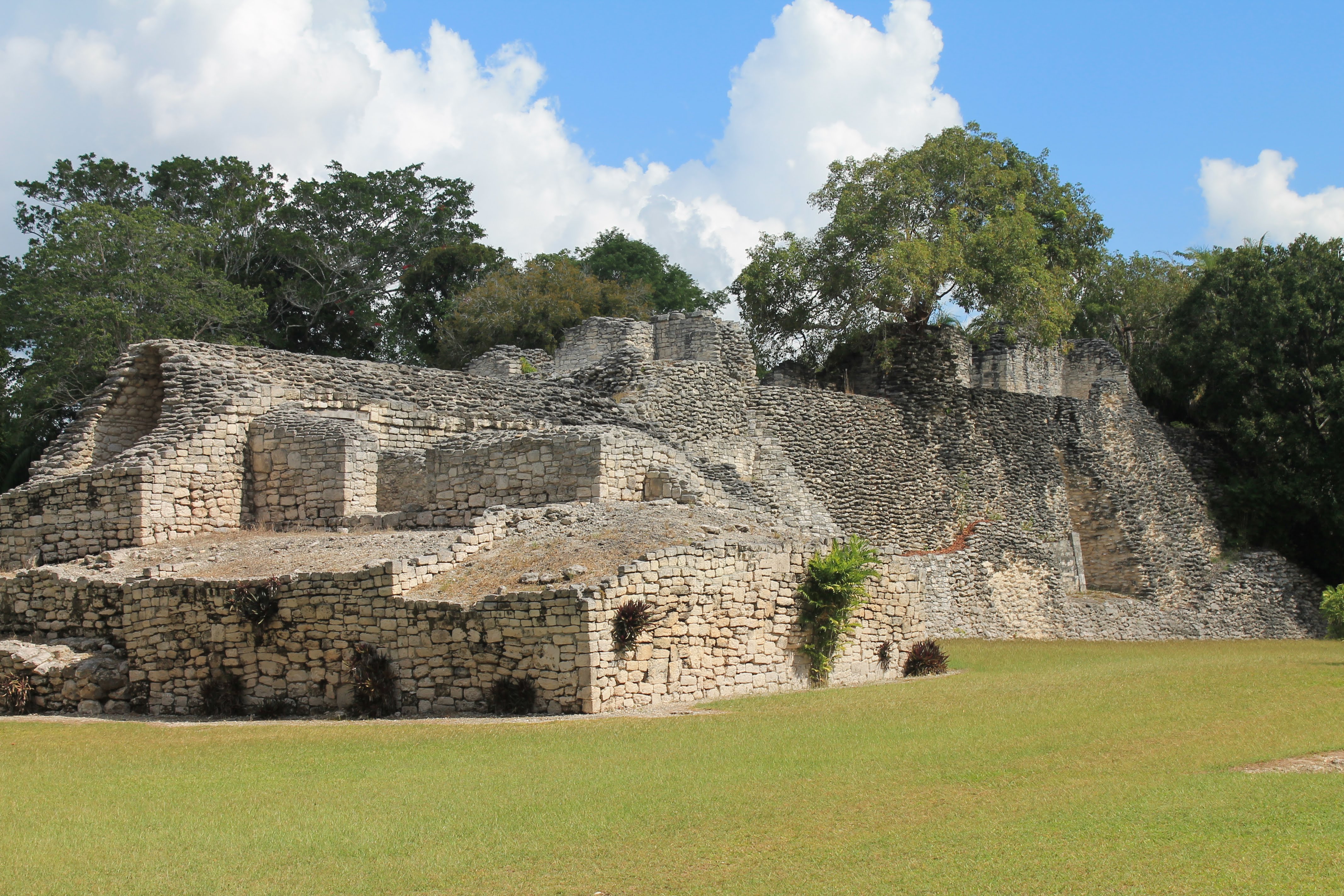
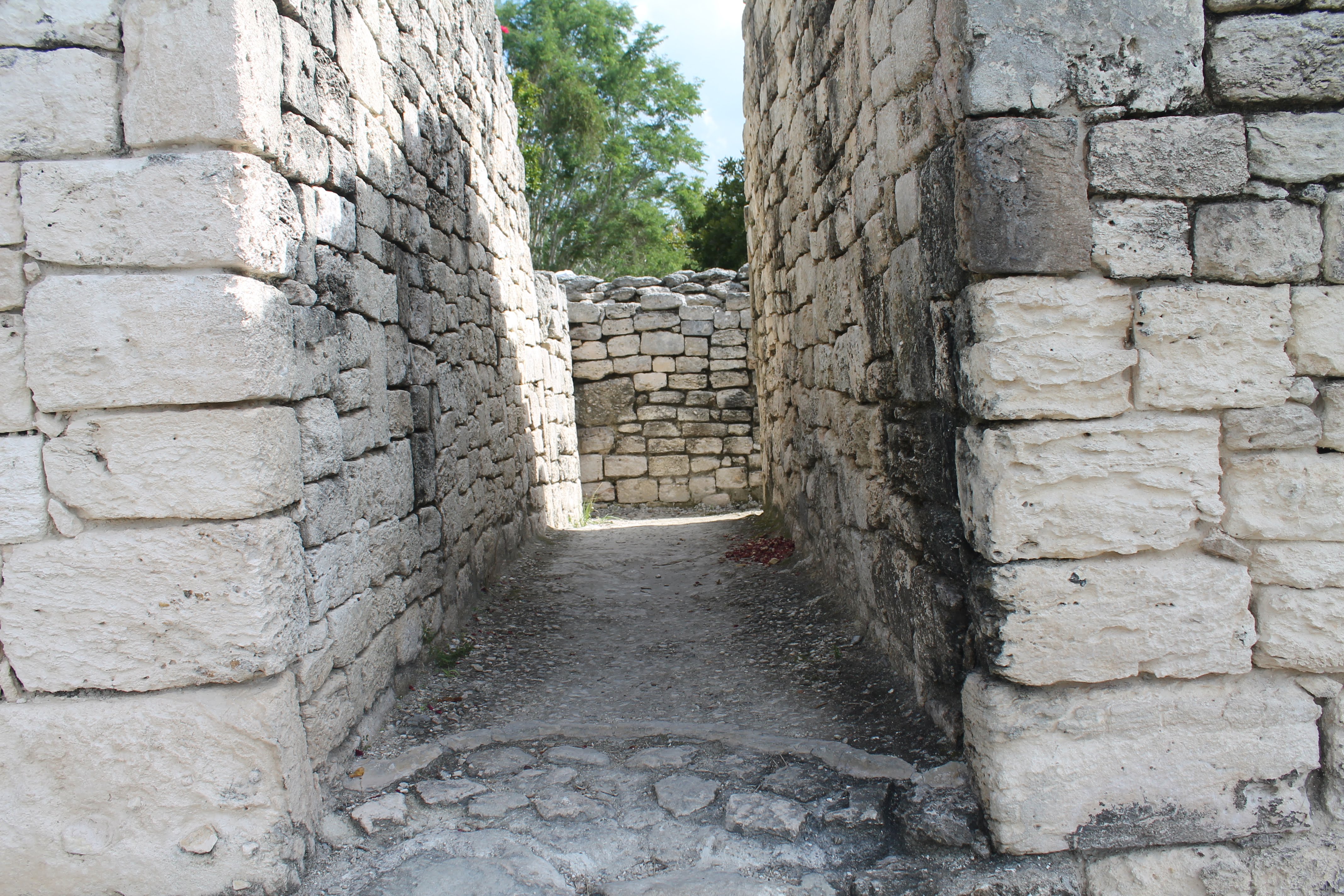
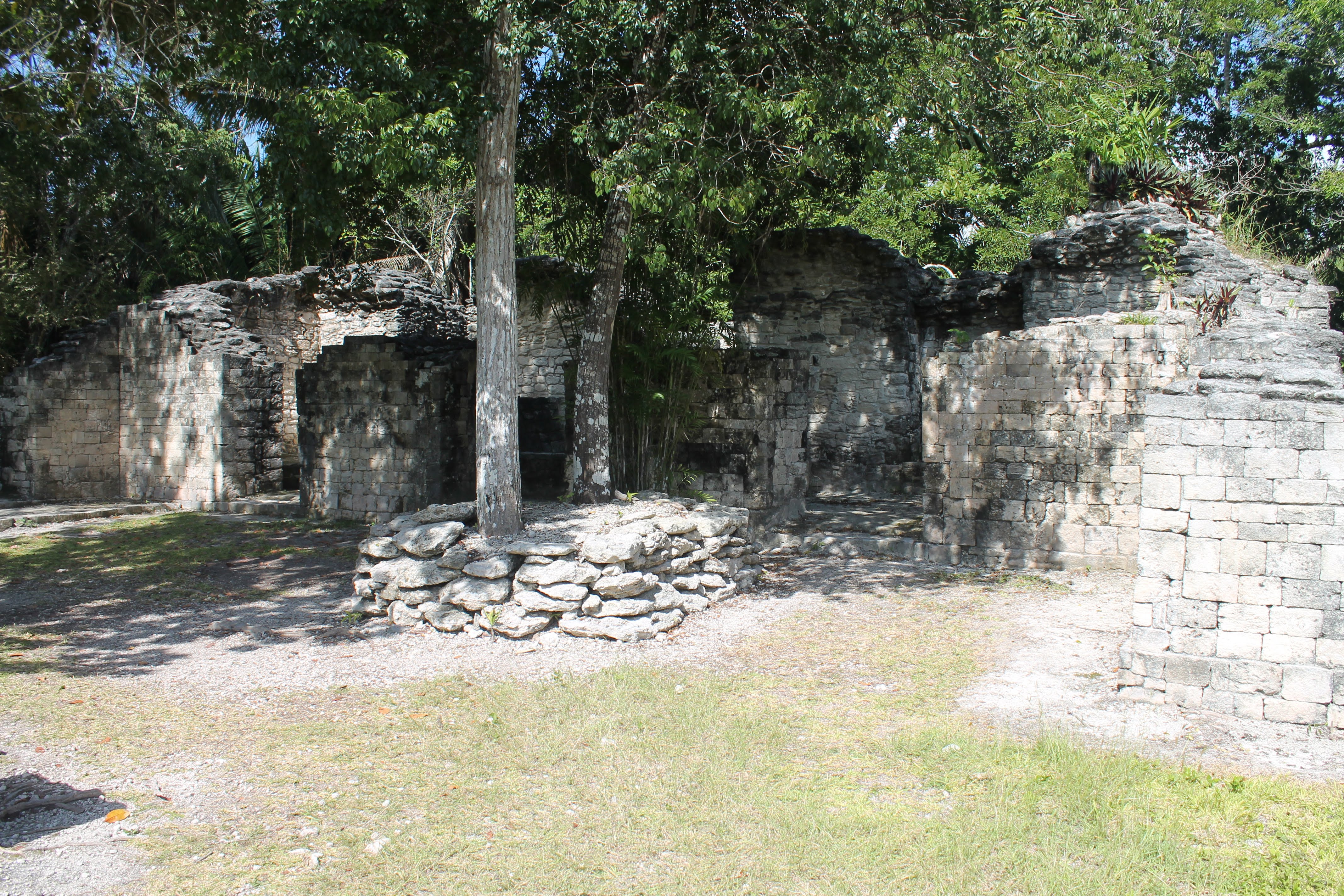
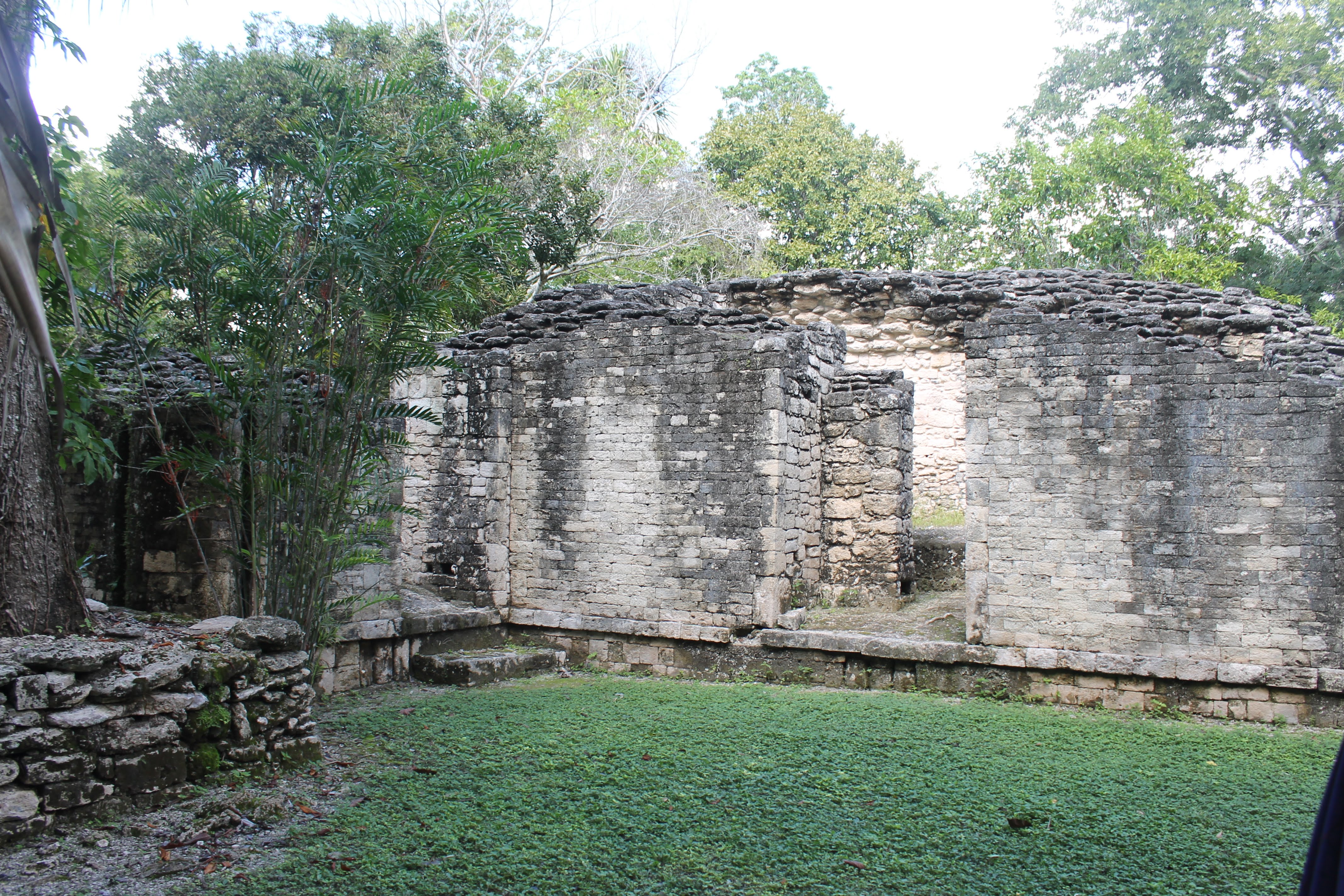
Our new guide, who was dressed in the official tan outfit of a park employee, led us down a path through the forest. It wasn’t quite a jungle, but we did see a lot of diverse fauna and colorful tropical flowers. As we walked he told us a little about the Mayans and the structures we were about to explore. The Mayans thrived here from 3000 BC to 1000 AD. Based on the many thousands of Mayan sights discovered Archaeologists have concluded that the Mayans populated all of the Yucatan Peninsula and most of Mesoamerica that includes present day Guatemala, Belize, Honduras and El Salvador. Scientist have also been able to conclude that there was a drastic climate change around 1000 AD, a drought which meant not enough food production. With no rain in the rainy season, the rivers and underground water sources dried up. And since the Mayans mostly lived in these cities and the whole population depended on the crops that were grown outside and brought in to feed the people, they were in danger of mass starvation. Archaeologist have determined that it was during this dry spell, that the Mayans’ left the cities, migrating to other parts of the country where they could survive. As a result no one was left and the jungle eventually took over the great structures these amazing people built and maintained for thousands of years. When we got to the clearing where the ancient Mayan structures were our guide gave us a brief explanation of the structures around us, then we were left to explore on our own.
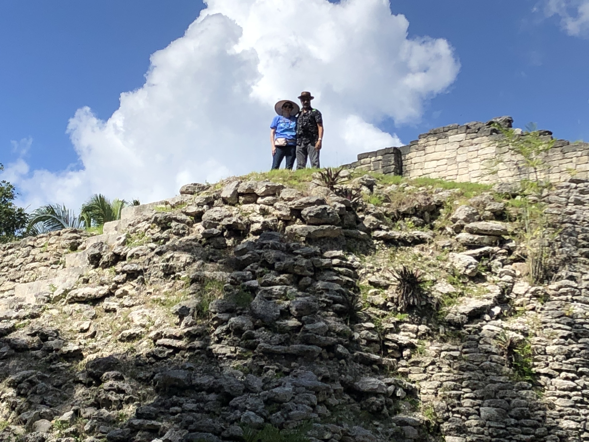
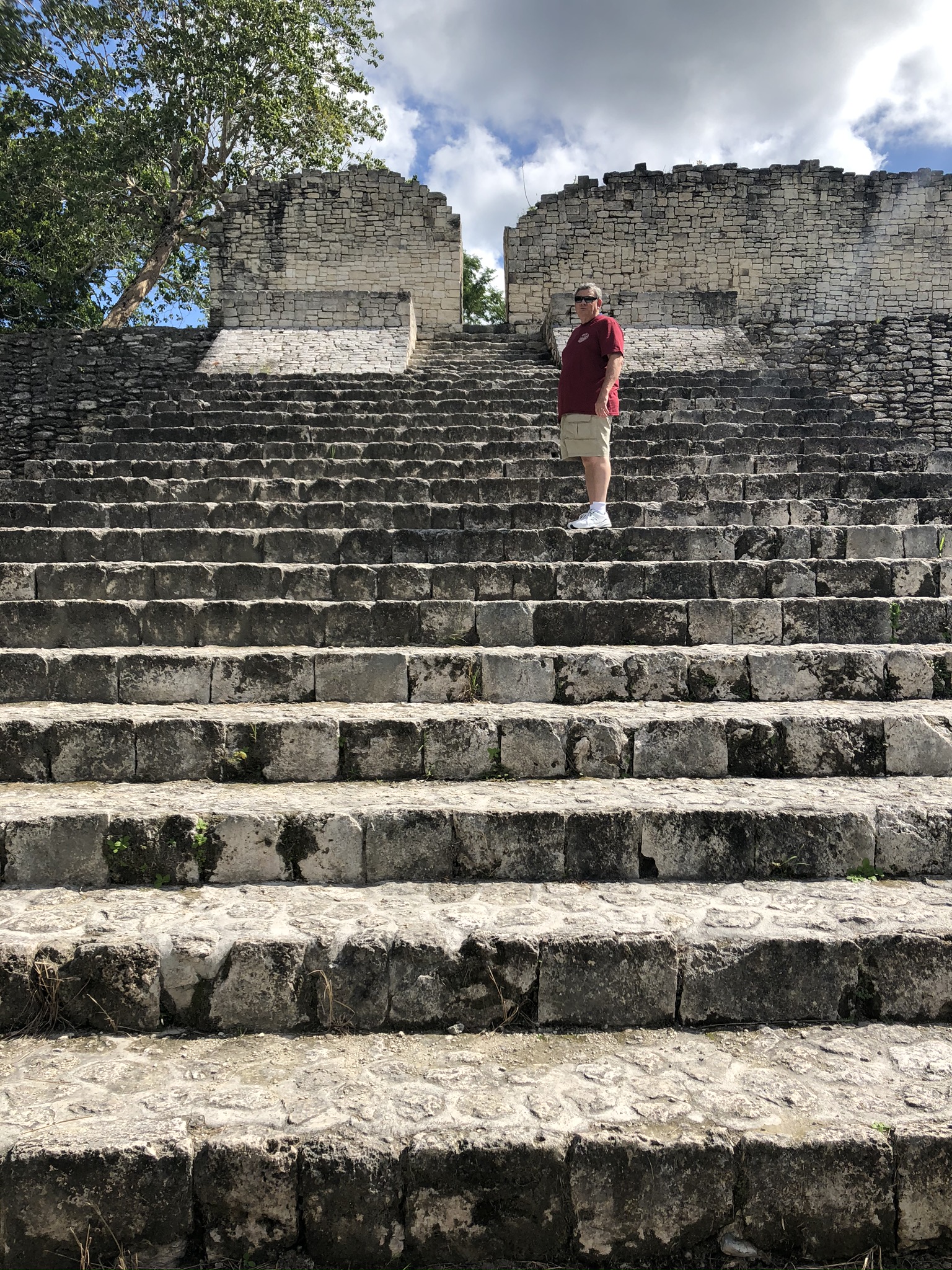
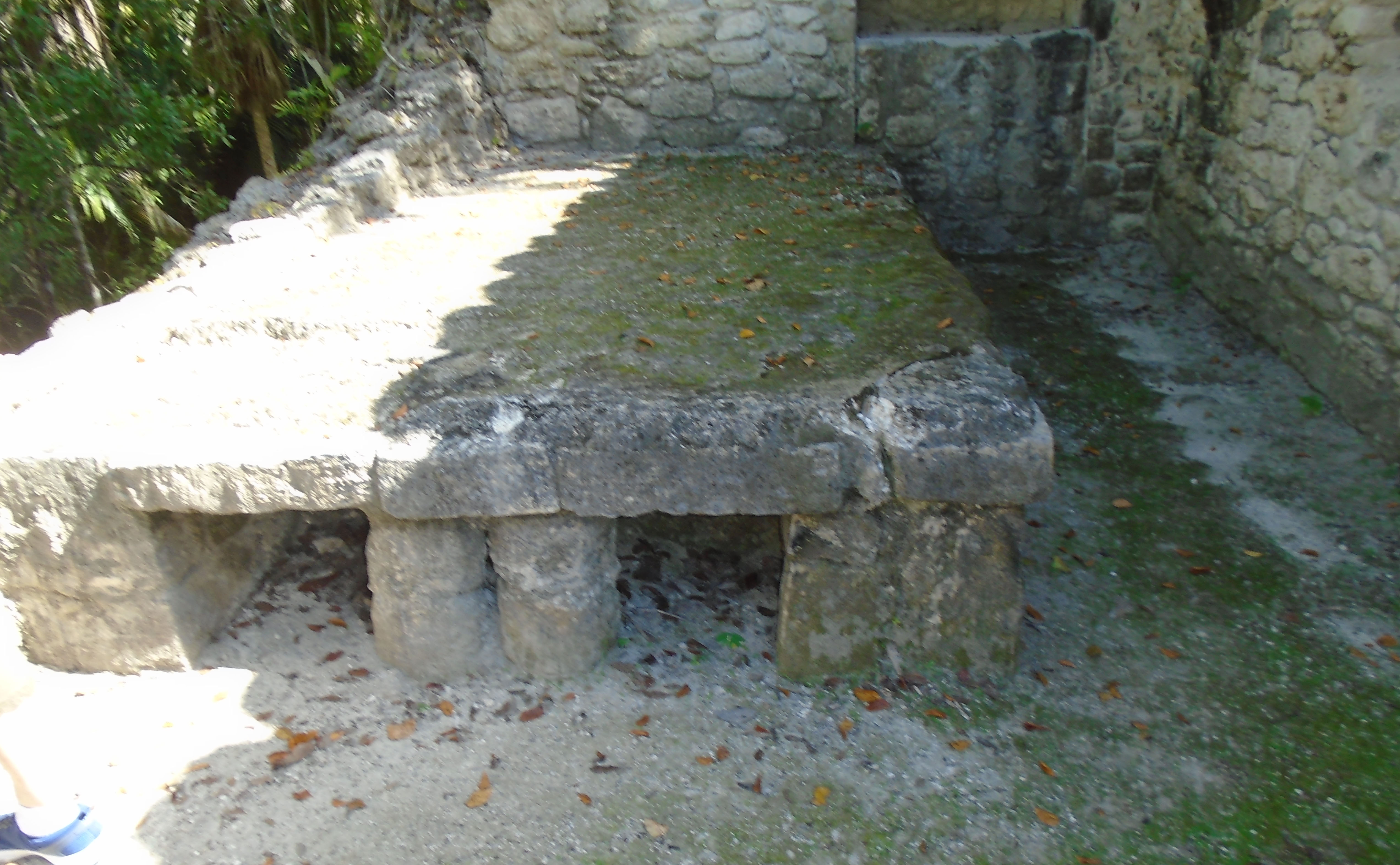
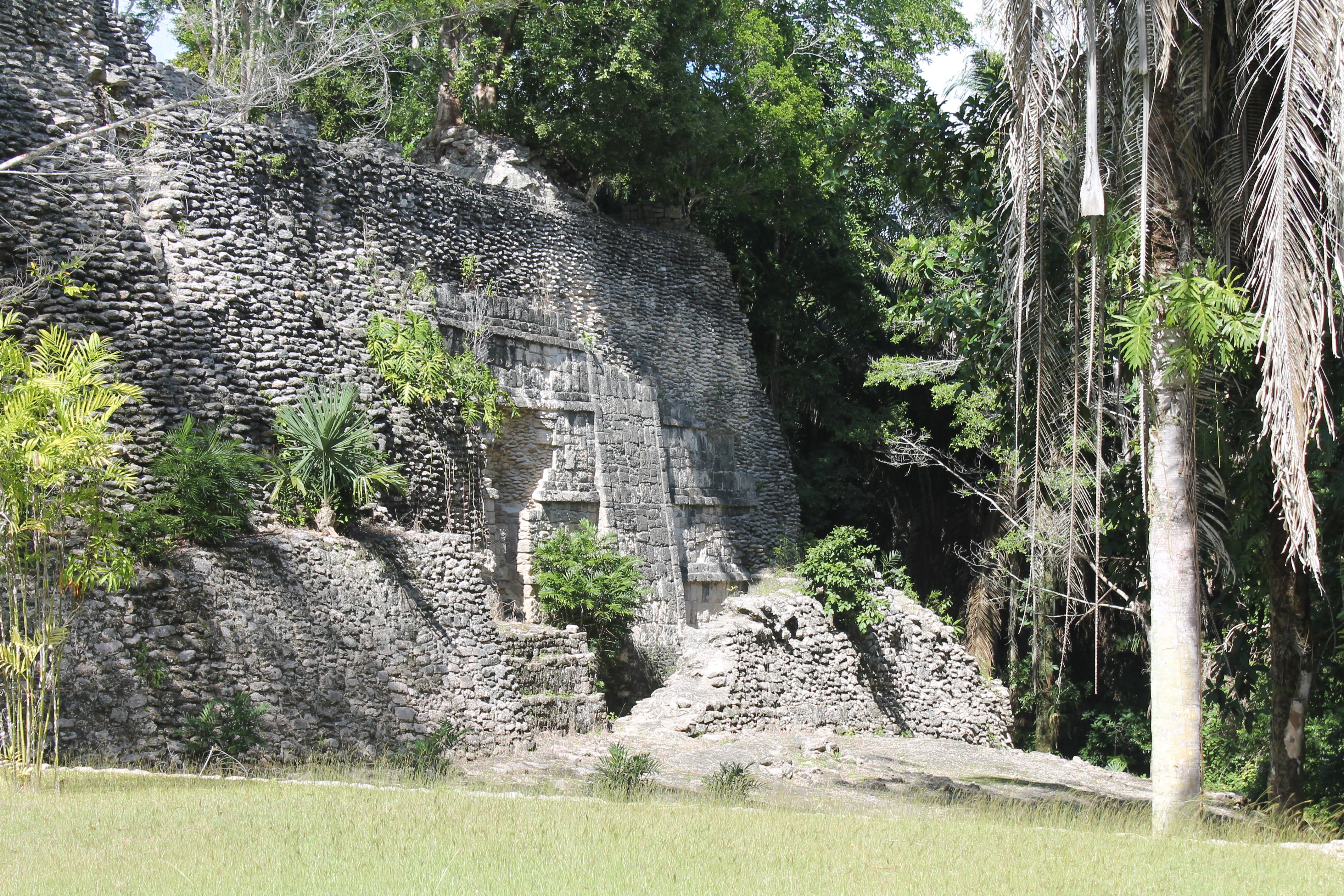
Before us was a pyramid with many steps and a flat top. I was determined to climb to the top, left knee be dammed. So we all made our way to the top where we could see out over the trees to another pyramid at another site. Our guide said that it is believed that from these two high points people communicated with one another, via signals flags or some other highly visible means. There were altars and cubby holes, and benches. We went from one structure to another, many looked to be shared public spaces, others may have been private homes. We moved through what appeared to be rooms in a living area with cubby holes under beds and benches, up and down lots of very big steps. The site was very impressive and not overly touristy. We had to rejoin our guide after about an hour, and were led along a path through the woods to another site where we saw many more buildings and smaller pyramid like structures. One had two large carved heads possibly their deities or possibly important leaders. By this time I was visibly limping and Joe was feeling the effects of the heat and so we opted not to trek to the top of the last pyramid. Rudy found a small square of concrete embedded with a metal tag of sorts. Upon closer inspection he realized it was the GPS coordinates, degrees of latitude and longitude, our exact location on the globe. Rudy found other GPS tags also and took photos, of course.
Our group explored for about 2 hours, then we met back at the bus where we were handed a bag lunch; a white bread sandwich with one very anemic single slice of ham and a slice of processed cheese, a banana and one small snack bar, a tiny bag of hard roasted chick peas, and a bottle water. At least it was cold. We all had been over eating for the last four days onboard the ship, so it was good to go light on lunch, especially in the heat.


On the bus ride back, I began complaining about my aching knee which led to the following conversation:
Me: “I’m tired of my knee hurting. I just want to get a new knee and be done with it.”
Joe: “I hear ya. My right knee is killing me.”
Me: “Yeah, between us we have two good legs.”
Joe: “Maybe we could both get new knees. A two-fer. I’ll bet Jeff Bezos sells knees on Amazon.”
Me: “Yeah, but who would install them for us?”
Joe: “I could watch You-Tube videos and do it.” And so we decided that this was our best option. After all Joe has tackled many projects armed only with a “How to do it” video on You-Tube.
A few hours later we were deposited in Costa Maya and headed back to the ship. Later, after we were on the top deck, we ran into De and Rudy. She was disturbed by the sight of my left leg. “Oh my God! Look at your leg.” And so I did. It was swollen twice the size of my right. Not just the knee, but my calf was huge. I obviously had cut off the circulation with the brace and sitting on the bus with my leg bent in one position for over 4 hours did the trick. We showered and enjoyed a nice dinner at Windjammer. Back in our cabin, I took 4 Ibuprofen, parked myself on the balcony with a glass of wine and a bag of ice on my propped up left knee, watching as the lights of Costa Maya receded and we headed north following the coast of Mexico.
Read Next Post Dec 13, A Mexican Christmas & Cozumel, Mexico
Read Previous Post Dec 11, Roatan, Mexico

